Eyjafjörður, north east Iceland
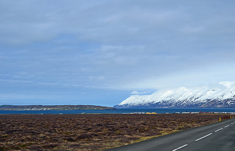
Eyjafjörður is the longest fjord in Iceland and is located in the central north of the country.
Eyjafjörður is long and narrow and measures 37 miles from north to south. Its greatest width is 15.5 miles between Siglunes and Gjögurtá at the fjord's mouth but for the greater part of its length it is usually 3.5 to 6.5 miles wide. Two smaller fjords branch out of Eyjafjörður's west side, namely Ólafsfjörður and Héðinsfjörður.
Eyjafjörður is surrounded by hills and mountains on both sides but the mountains are considerably taller on the west side in the mountain range of the Tröllaskagi peninsula. In the outer part of the fjord there are no lowlands along the coast as the steep hills roll directly into the sea. Further south in the fjord there are strips of lowland along both coasts and these are widest on the west side.
Several valleys lead from Eyjafjörður, most of them to the west where the two most significant are: Hörgárdalur and Svarfaðardalur. Dalsmynni is the only valley on the east side. However the greatest valley in Eyjafjörður is also called Eyjafjörður and runs directly south from the fjord itself. It is long and wide and home to one of Iceland's largest agricultural regions.
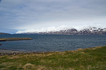
The island of Hrísey in the middle of Eyjafjörður is the second largest island off the coast of Iceland and often referred to as "The Pearl of Eyjafjörður".
The region of Eyjafjörður is Iceland's second most populous one after the Capital Region in south west Iceland. The largest town by far is Akureyri and other settlements in the region include Dalvík, Ólafsfjörður, Hrísey, Árskógssandur, Hauganes, Hjalteyri, Hrafnagil, Svalbarðseyri and Grenivík. Most of these settlements base their livelihood on fisheries and agriculture but Akureyri is a service centre as well.
Date: 4th June 2015
Location: view from the road to Haugarnes looking east towards Hrísey
Eyjafjörður is long and narrow and measures 37 miles from north to south. Its greatest width is 15.5 miles between Siglunes and Gjögurtá at the fjord's mouth but for the greater part of its length it is usually 3.5 to 6.5 miles wide. Two smaller fjords branch out of Eyjafjörður's west side, namely Ólafsfjörður and Héðinsfjörður.
Eyjafjörður is surrounded by hills and mountains on both sides but the mountains are considerably taller on the west side in the mountain range of the Tröllaskagi peninsula. In the outer part of the fjord there are no lowlands along the coast as the steep hills roll directly into the sea. Further south in the fjord there are strips of lowland along both coasts and these are widest on the west side.
Several valleys lead from Eyjafjörður, most of them to the west where the two most significant are: Hörgárdalur and Svarfaðardalur. Dalsmynni is the only valley on the east side. However the greatest valley in Eyjafjörður is also called Eyjafjörður and runs directly south from the fjord itself. It is long and wide and home to one of Iceland's largest agricultural regions.
The island of Hrísey in the middle of Eyjafjörður is the second largest island off the coast of Iceland and often referred to as "The Pearl of Eyjafjörður".
The region of Eyjafjörður is Iceland's second most populous one after the Capital Region in south west Iceland. The largest town by far is Akureyri and other settlements in the region include Dalvík, Ólafsfjörður, Hrísey, Árskógssandur, Hauganes, Hjalteyri, Hrafnagil, Svalbarðseyri and Grenivík. Most of these settlements base their livelihood on fisheries and agriculture but Akureyri is a service centre as well.
Date: 4th June 2015
Location: view from the road to Haugarnes looking east towards Hrísey
|

Also in: North east Iceland
 |  |  |  |  |
 |  |  |  |  |
 |  |  |  |  |