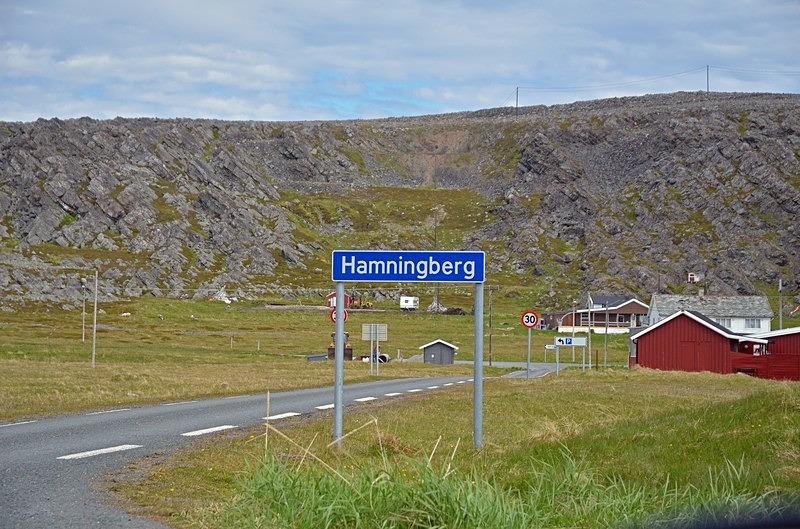
Hamingberg, Varanger peninsula, Troms og Finnmark, Norway
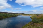
The Varanger peninsula is situated in Troms og Finnmark in the extreme north east of Norway. With an area of 800 square miles, it is the largest area within the Arctic climate zone in mainland Norway and is bordered by Tanafjord to the west, Varangerfjord to the south and the Barents Sea to the north and east. The area has a rugged mountain terrain with altitudes up to 2077 feet and it has an Arctic tundra climate.
The coast of the Varanger peninsula is an important area for breeding, migrating and wintering birds, especially some notable Arctic species. The Norwegian Directorate for Nature Management has a project on the Varanger peninsula to reintroduce and protect the Arctic Fox which is critically endangered on the Norwegian mainland.
The Varangerhalvøya National Park (Norwegian: Varangerhalvøya Nasjonalpark) lies to the west of road Fv341 and protects a majority of the land on the Varanger peninsula.
The eastern part of the Varanger peninsula can be accessed from Vardø, via Svartnes, to Hamningberg.
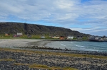
Hamningberg is an abandoned fishing village situated on the Varanger peninsula and on the shores of the Barents Sea. It’s only road connection is via the narrow and winding road Fv341 which runs for about 25 miles north from Svartnes. This is a very scenic road which follows the shores of the Barents Sea. It is considered to be one of the wildest and most memorable drives in Norway and passes through a bare and barren but awe-inspiring Arctic landscape. The road is closed during the winter months from October to late May.
Traditionally a fishing village, Hamningberg is one of very few places in Troms og Finnmark that was not burnt and destroyed under Operation Nordlicht in 1944 and 1945, the German “scorched earth” retreat from Finnmark. It was depopulated and abandoned in 1964 although some of the houses are still in use as summer cottages.
Date: 2nd July 2019
Location: Hamningberg, Varanger peninsula, Troms og Finnmark, Norway
The coast of the Varanger peninsula is an important area for breeding, migrating and wintering birds, especially some notable Arctic species. The Norwegian Directorate for Nature Management has a project on the Varanger peninsula to reintroduce and protect the Arctic Fox which is critically endangered on the Norwegian mainland.
The Varangerhalvøya National Park (Norwegian: Varangerhalvøya Nasjonalpark) lies to the west of road Fv341 and protects a majority of the land on the Varanger peninsula.
The eastern part of the Varanger peninsula can be accessed from Vardø, via Svartnes, to Hamningberg.
Hamningberg is an abandoned fishing village situated on the Varanger peninsula and on the shores of the Barents Sea. It’s only road connection is via the narrow and winding road Fv341 which runs for about 25 miles north from Svartnes. This is a very scenic road which follows the shores of the Barents Sea. It is considered to be one of the wildest and most memorable drives in Norway and passes through a bare and barren but awe-inspiring Arctic landscape. The road is closed during the winter months from October to late May.
Traditionally a fishing village, Hamningberg is one of very few places in Troms og Finnmark that was not burnt and destroyed under Operation Nordlicht in 1944 and 1945, the German “scorched earth” retreat from Finnmark. It was depopulated and abandoned in 1964 although some of the houses are still in use as summer cottages.
Date: 2nd July 2019
Location: Hamningberg, Varanger peninsula, Troms og Finnmark, Norway
|
Also in: North Norway
 |  |  |  |  |
 |  |  |  |  |
 |  |  |  |  |