Malhamdale, North Yorkshire
Malhamdale is the name given to the upper reaches of the valley of the River Aire.
The landscape of Malhamdale is dominated by the influence of limestone and includes some of the most spectacular examples of this type of scenery within the Yorkshire Dales National Park and within the UK as a whole.
The roads north from Malham village join near Malham Tarn which lies on a bedrock of slates in a depression scoured out by glacier ice in the Ice Age and is the highest lime-rich lake in the country.
A stream from Malham Tarn disappears into the ground through sink holes in the limestone and reappears at Airehead Springs.
Date: 10th April 2006
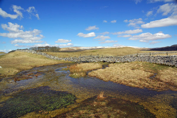
Location: view from near Malham Tarn
The landscape of Malhamdale is dominated by the influence of limestone and includes some of the most spectacular examples of this type of scenery within the Yorkshire Dales National Park and within the UK as a whole.
The roads north from Malham village join near Malham Tarn which lies on a bedrock of slates in a depression scoured out by glacier ice in the Ice Age and is the highest lime-rich lake in the country.
A stream from Malham Tarn disappears into the ground through sink holes in the limestone and reappears at Airehead Springs.
Date: 10th April 2006
Location: view from near Malham Tarn
|
Also in: Mountains and uplands
 |  |  |  |  |
 |  |  |  |  |
 |  |  |  |  |