Eyjafjallajökull, south Iceland
Eyjafjallajökull is located to the north of Skógar and to the west of Mýrdalsjökull in south Iceland.
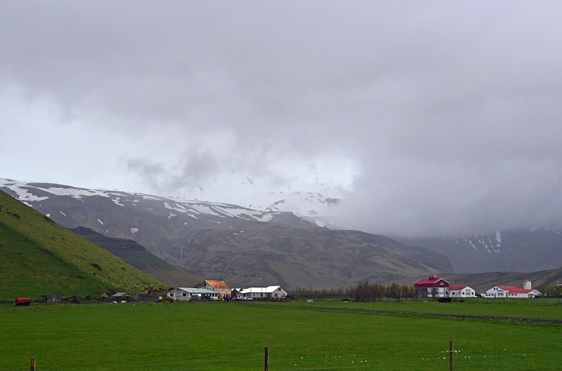
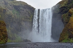
Eyjafjallajökull consists of a volcano completely covered by an ice cap. The ice cap covers an area of about 39 square miles and feeds many outlet glaciers mainly to the north. The mountain itself is a stratovolcano and stands 5417 feet at its highest point. It has a crater 1.9 to 2.5 miles in diameter which is open to the north. The crater rim has 3 main peaks: Guðnasteinn, Hámundur and Goðasteinn. The south face of the mountain was once part of Iceland's Atlantic coastline but over thousands of years the sea has retreated some 3 miles. The former coastline now consists of sheer cliffs with many waterfalls (of which the best known is Skógafoss) but the area between Eyjafjallajökull and the present coast is a relatively flat strand, 1 to 3 miles wide, called Eyjafjöll.
Eyjafjallajökull has erupted relatively frequently since the last glacial period, most recently and notably in 2010.
On 26th February 2010, unusual seismic activity along with rapid expansion of the Earth's crust was registered by the Meteorological Institute of Iceland. This gave geophysicists evidence that magma was pouring from underneath the crust into the magma chamber of the Eyjafjallajökull volcano. Pressure stemming from the process caused the huge crustal displacement at Þorvaldseyri farm. The seismic activity continued to increase and from 3rd to 5th March 2010 almost 3000 earthquakes were measured at the epicentre of the volcano.
The eruption is thought to have begun on 20th March 2010 about 5 miles east of the top crater of Eyjafjallajökull on Fimmvörðuháls, the high neck between Eyjafjallajökull and the neighbouring icecap of Mýrdalsjökull. This first eruption, in the form of a fissure vent, did not occur under the glacier and was smaller in scale than had been expected by some geologists.
On 14th April 2010 Eyjafjallajökull resumed erupting after a brief pause, this time from the top crater in the centre of the glacier, causing meltwater floods to rush down the nearby rivers and requiring 800 people to be evacuated. This eruption was explosive in nature due to melt water getting into the volcanic vent. It was estimated to be 10 to 20 times larger than the previous one in Fimmvörðuháls. This second eruption threw volcanic ash several miles up in the atmosphere which led to the closure of airspace and air travel disruption in north west Europe for 6 days from 15th April to 21st April 2010. It caused a significant delay in my own return from a trip to north Norway and north Finland
On 23rd May 2010, the eruption was declared to have stopped but monitoring continued. The volcano continued to have several earthquakes daily but since August 2010 Eyjafjallajökull has been considered dormant.
Date: 8th June 2015
Location: view of farms below Eyjafjallajökull near Hvolsvöllur
|
Also in: South Iceland
 |  |  |  |  |
 |  |  |  |  |
 |  |  |  |  |