Low Tatras, Slovakia
The Low Tatras (Nízke Tatry) are a mountain range of the Inner Western Carpathians situated in central Slovakia. They are located south of the High Tatras (Vysoké Tatry) from which they are separated by the valleys of the Váh River and Poprad River. The ridge runs west to east and is about 50 miles long.
The Čertovica pass divides the range into 2 parts. The highest peaks of the Low Tatras are located in its western part. Ďumbier is the highest mountain at 6703 feet. Its neighbour Chopok at 6640 feet is accessible by a chairlift and it is the most visited place in the Low Tatras. Other peaks in the western part include Dereše at 6575 feet and Chabenec at 6414 feet. The highest peak in the eastern part is Kráľova hoľa at 6385 feet.
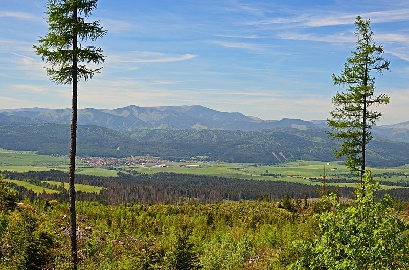
The lower elevations are mostly blanketed in dense forest with prevailing coniferous forests in the northern part and mixed forests in the south. At higher elevations there are tarns, deep valleys, limestone cliffs and impressive granite formations.
Most of the Low Tatras are protected by the Low Tatras National Park (Národný park Nízke Tatry). This comprises an area of 281 square miles and a buffer zone covering an area of 425 square miles. This makes it the largest National Park in Slovakia.
The protection of the Low Tatras started with the first attempts during the period 1918 to 1921 and continuing after World War 2. In 1963, a proposal was made for the establishment of a National Park under the name Central Slovakia National Park. During the period between 1965 and 1966 and right before the completion of the last proposal, a draft for a National Park Ďumbier was proposed. The aim of this draft was to include the north and south part of the central territory of the Low Tatras. From 1967 until 1968 the draft was reformulated with the goal to establish the National Park on the 25th anniversary of the Slovak National Uprising.
However, it took another 10 years to overcome various obstacles that prevented the establishment of the National Park. In 1978 the National Park was finally created with the Regulation 119/1978 of the Slovak Socialistic Republic. The area of the national park was set at 313 square miles and its protection zone at 479 square miles. The status of the National Park was published in the same year by the Ministry of Culture of the Slovak Socialistic Republic in Regulation 120/1978. This regulation set out the conditions for the protection of particular areas.
The borders of the National Park and the protection zones were revised in June 1997 by Regulation 182/1997 of the government of the Slovak Republic. The revised area of the National Park was adjusted to 281 square miles which is 32 square miles less than the original area. The revised area of the protection zones was adjusted to 425 square miles which is 53 square miles less than the original area.
Currently, the following protected areas are established in the Low Tatras National Park or its buffer zone: 10 National Nature Reserves, 10 Nature Reserves, 5 National Nature Monuments, 6 Nature Monuments and 1 Protected Site.
The Low Tatras are the second most visited mountains in Slovakia after the High Tatras. Tourism is very popular and during the winter there are several ski resorts such as Jasná and Tále. There are also a range of summer activities such as hiking, trekking, rafting, kayaking, fishing and other outdoor pursuits.
Date: 29th May 2017
Location: Low Tatras, Slovakia
The Čertovica pass divides the range into 2 parts. The highest peaks of the Low Tatras are located in its western part. Ďumbier is the highest mountain at 6703 feet. Its neighbour Chopok at 6640 feet is accessible by a chairlift and it is the most visited place in the Low Tatras. Other peaks in the western part include Dereše at 6575 feet and Chabenec at 6414 feet. The highest peak in the eastern part is Kráľova hoľa at 6385 feet.
The lower elevations are mostly blanketed in dense forest with prevailing coniferous forests in the northern part and mixed forests in the south. At higher elevations there are tarns, deep valleys, limestone cliffs and impressive granite formations.
Most of the Low Tatras are protected by the Low Tatras National Park (Národný park Nízke Tatry). This comprises an area of 281 square miles and a buffer zone covering an area of 425 square miles. This makes it the largest National Park in Slovakia.
The protection of the Low Tatras started with the first attempts during the period 1918 to 1921 and continuing after World War 2. In 1963, a proposal was made for the establishment of a National Park under the name Central Slovakia National Park. During the period between 1965 and 1966 and right before the completion of the last proposal, a draft for a National Park Ďumbier was proposed. The aim of this draft was to include the north and south part of the central territory of the Low Tatras. From 1967 until 1968 the draft was reformulated with the goal to establish the National Park on the 25th anniversary of the Slovak National Uprising.
However, it took another 10 years to overcome various obstacles that prevented the establishment of the National Park. In 1978 the National Park was finally created with the Regulation 119/1978 of the Slovak Socialistic Republic. The area of the national park was set at 313 square miles and its protection zone at 479 square miles. The status of the National Park was published in the same year by the Ministry of Culture of the Slovak Socialistic Republic in Regulation 120/1978. This regulation set out the conditions for the protection of particular areas.
The borders of the National Park and the protection zones were revised in June 1997 by Regulation 182/1997 of the government of the Slovak Republic. The revised area of the National Park was adjusted to 281 square miles which is 32 square miles less than the original area. The revised area of the protection zones was adjusted to 425 square miles which is 53 square miles less than the original area.
Currently, the following protected areas are established in the Low Tatras National Park or its buffer zone: 10 National Nature Reserves, 10 Nature Reserves, 5 National Nature Monuments, 6 Nature Monuments and 1 Protected Site.
The Low Tatras are the second most visited mountains in Slovakia after the High Tatras. Tourism is very popular and during the winter there are several ski resorts such as Jasná and Tále. There are also a range of summer activities such as hiking, trekking, rafting, kayaking, fishing and other outdoor pursuits.
Date: 29th May 2017
Location: Low Tatras, Slovakia

|

Also in: Slovakia
 |  |  |  |  |
 |  |  |  |  |
 |  |  |  |  |