Loch Assynt, Highland
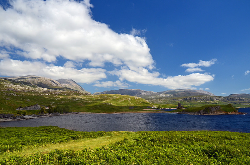
The area east of Lochinver is a remote wilderness of mountains and moorland dotted with lochs and lochans. Loch Assynt extends for 6 miles north west from Inchnadamph with the River Inver flowing out of its western end and down to the sea at Lochinver. To the north lies Quinag, to the south Suilven and Cansip and to the east Ben More Assynt.
The A837 Lochinver to Lairg road meets the A894 to Durness 10 miles east of Lochinver at Skiag Bridge by Loch Assynt. Nearby are the ruins of Ardvreck Castle. The castle dates from 1597 and was the stronghold of the Macleods of Assynt until a siege of the castle in 1691, when it was taken by the Seaforth Mackenzies.
Date: 24th June 2018
Location: view from the A837 road between Skiag Bridge and Inchnadamph
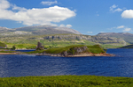
|
Also in: Lakes and lochs
 |  |  |  |  |
 |  |  |  |  |
 |  |  |  |  |