Pasvikdalen, Troms og Finnmark, Norway
The Pasvik valley (Norwegian: Pasvikdalen) is a river valley located in Norway and Russia. The Norwegian side of the valley is situated in Sør-Varanger municipality in Troms og Finnmark and the Russian side is located in the Pechengsky district in Murmansk Oblast.
Øvre Pasvik National Park (Norwegian: Øvre Pasvik Nasjonalpark) is located in the south eastern part of the valley and covers an area of 46 square miles. It is dominated by Siberian-like taiga consisting of old-growth forests of Scots pine, shallow lakes and bogs. Proposals for a national park in Øvre Pasvik were first launched in 1936 but it was not created until February 1970. It originally covered 25 square miles but was expanded in August 2003. Øvre Pasvik National Park is part of the larger Pasvik–Inari Trilateral Park along with the adjacent Øvre Pasvik Landscape Protection Area, the joint Norwegian and Russian Pasvik Nature Reserve and Finland's Vätsäri Wilderness Area.
The fauna and flora of the Øvre Pasvik National Park is typical of the Siberian taiga. This includes Brown Bear, Wolverine, Wolf, Lynx and Elk and a very interesting diversity of northern and eastern species of birds which breed on the lakes and rivers and in the forests.
The River Pasvikelva runs through the valley (giving it the name) and the river defines part of the border between Norway and Russia. It is the outlet from the large Lake Inari in Finland and flows through Norway and Russia to discharge into the Bøkfjorden (which later flows into the Varangerfjorden and then the Barents Sea) not far from the town of Kirkenes. The river has a watershed of 7106 square miles and is 90 miles long. A series of hydroelectric power stations are situated along its course. Since 1826, the River Pasvikelva has marked parts of the border between Norway and Russia, except from 1920 to 1944 when it was along the border between Norway and Finland.
The southern part of the valley is also the location of the Treriksrøysa (Three-Country Cairn), a cairn which marks the tripoint where the borders between Norway, Finland and Russia meet. The site is on a hill called Muotkavaara situated west of the River Pasvikelva. It is the only place where 3 time zones meet: Central European Time, Eastern European Time and Further-Eastern European Time. The tripoint can only be approached by the public from the Norwegian side since both Finland and Russia maintain extensive border zones where public access is prohibited.
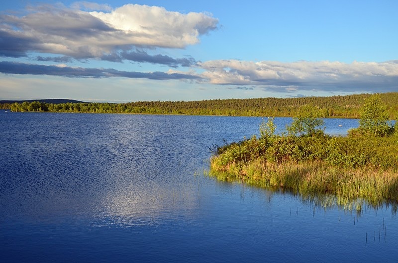
Date: 29th June 2019
Location: view between Melkefoss and Nyrud, Troms og Finnmark, Norway
Øvre Pasvik National Park (Norwegian: Øvre Pasvik Nasjonalpark) is located in the south eastern part of the valley and covers an area of 46 square miles. It is dominated by Siberian-like taiga consisting of old-growth forests of Scots pine, shallow lakes and bogs. Proposals for a national park in Øvre Pasvik were first launched in 1936 but it was not created until February 1970. It originally covered 25 square miles but was expanded in August 2003. Øvre Pasvik National Park is part of the larger Pasvik–Inari Trilateral Park along with the adjacent Øvre Pasvik Landscape Protection Area, the joint Norwegian and Russian Pasvik Nature Reserve and Finland's Vätsäri Wilderness Area.
The fauna and flora of the Øvre Pasvik National Park is typical of the Siberian taiga. This includes Brown Bear, Wolverine, Wolf, Lynx and Elk and a very interesting diversity of northern and eastern species of birds which breed on the lakes and rivers and in the forests.
The River Pasvikelva runs through the valley (giving it the name) and the river defines part of the border between Norway and Russia. It is the outlet from the large Lake Inari in Finland and flows through Norway and Russia to discharge into the Bøkfjorden (which later flows into the Varangerfjorden and then the Barents Sea) not far from the town of Kirkenes. The river has a watershed of 7106 square miles and is 90 miles long. A series of hydroelectric power stations are situated along its course. Since 1826, the River Pasvikelva has marked parts of the border between Norway and Russia, except from 1920 to 1944 when it was along the border between Norway and Finland.
The southern part of the valley is also the location of the Treriksrøysa (Three-Country Cairn), a cairn which marks the tripoint where the borders between Norway, Finland and Russia meet. The site is on a hill called Muotkavaara situated west of the River Pasvikelva. It is the only place where 3 time zones meet: Central European Time, Eastern European Time and Further-Eastern European Time. The tripoint can only be approached by the public from the Norwegian side since both Finland and Russia maintain extensive border zones where public access is prohibited.
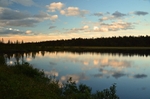
Date: 29th June 2019
Location: view between Melkefoss and Nyrud, Troms og Finnmark, Norway

|
Also in: North Norway
 |  |  |  |  |
 |  |  |  |  |
 |  |  |  |  |