Topoľa, Prešov region, Slovakia
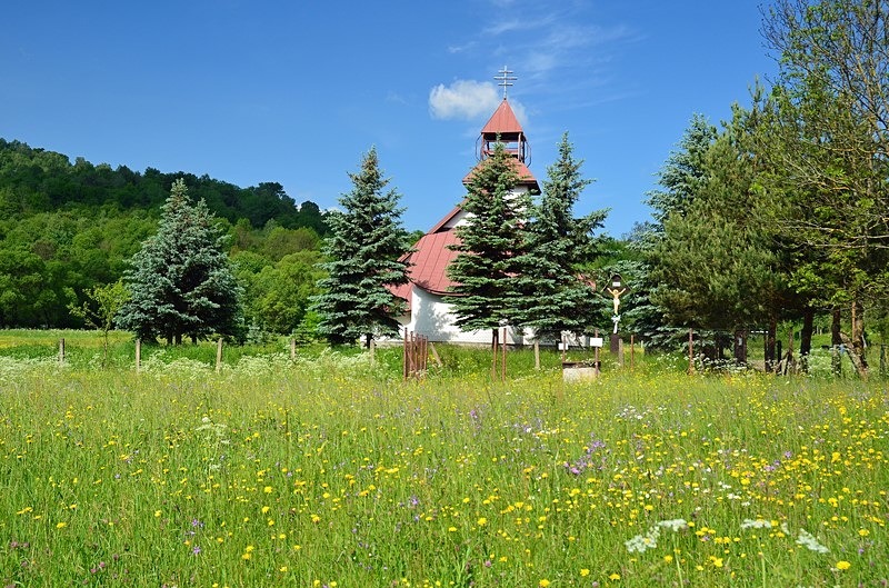
Topoľa is a small village in the Prešov region of north east Slovakia. It is located in the buffer zone of the Poloniny National Park (Národný park Poloniny). The name of the village means poplar (topoli). In historical records the village was first mentioned in 1337. The Greek Catholic wooden church of Archangel Michael located on the hill above the village dates back as far as 1700.
The Poloniny National Park (Národný park Poloniny) was created in October 1997 with a protected area of 115 square miles and a buffer zone of 42 square miles. The highest point of the national park lies at 3,963 feet at a point where the borders of Slovakia, Poland and Ukraine meet near the summit of Kremenec. The national park is the easternmost and the least populated area of Slovakia but there are many winter (cross-country skiing) and summer hiking trails. Besides the several mountain trails, there is also one connecting outstanding wooden churches from the 18th century at Topoľa, Uličské Krivé and Ruský Potok
Date: 1st June 2017
Location: Topoľa, Prešov region, Slovakia

|
Also in: Slovakia
 |  |  |  |  |
 |  |  |  |  |
 |  |  |  |  |