Foula, Shetland
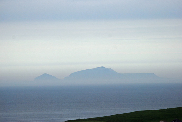
Foula is one of the UK’s most remote permanently inhabited islands and measures 2.5 miles by 3.5 miles with an area of 4.9 square miles. It is the seventh largest of the Shetland Islands.
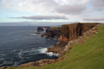
The crofting townships on the narrow coastal strip are dwarfed by the island's 5 dramatic peaks (Da Noup, Hamnafield, Da Sneug, Da Kame, and Soberlie). On the west coast are Shetland's biggest and most spectacular cliffs.
Foula's natural heritage is exceptionally rich and diverse for such a small area. The name means “Bird Island” in Old Norse and Foula is designated as a Special Protection Area (SPA) for birds, a National Scenic Area and a Site of Special Scientific Interest (SSSI) for its plants, birds and geology.
Foula has a population of less than 30 people and the nearest other settlement is about 17 miles across the Atlantic Ocean. The film “The Edge of the World” used Foula as its location.
Date: 31st May 2008
Location: view from South Mainland
|
Also in: Sea and sand
 |  |  |  |  |
 |  |  |  |  |
 |  |  |  |  |