Loch Eriboll, Sutherland
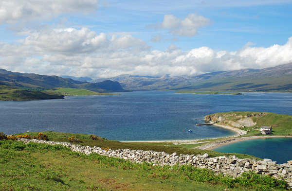
Loch Eriboll is a large and deep sea loch which was once used as a naval anchorage. It is located in north west Sutherland 4 miles east of Durness and 9 miles west of Tongue. The loch is around 1 mile wide for much of its length and widens considerably as it reaches the sea.
From Durness the A838 road turns south to begin its 10 mile route to where Loch Eriboll ends surrounded by the mountains of north west Sutherland.
Having rounded the end of the loch, the road then continues north east past Ard Neakie, the site of former Durness limestone kilns, and heads east towards Tongue.
Date: 5th June 2008
Location: view from the A838 road looking south west from the east shore near Ard Neakie

|
Also in: Sea and sand
 |  |  |  |  |
 |  |  |  |  |
 |  |  |  |  |